
DISRUPTIVE / INNOVATION / EVERGREEN
FILE Nº 029
Innovation · Evergreen
The Military System That Became the World's Clock: How GPS Ate Everything
Built to guide weapons, opened to civilians after a tragedy, unleashed by a single policy decision in May 2000 — GPS is now load-bearing infrastructure for nearly every industry on Earth.
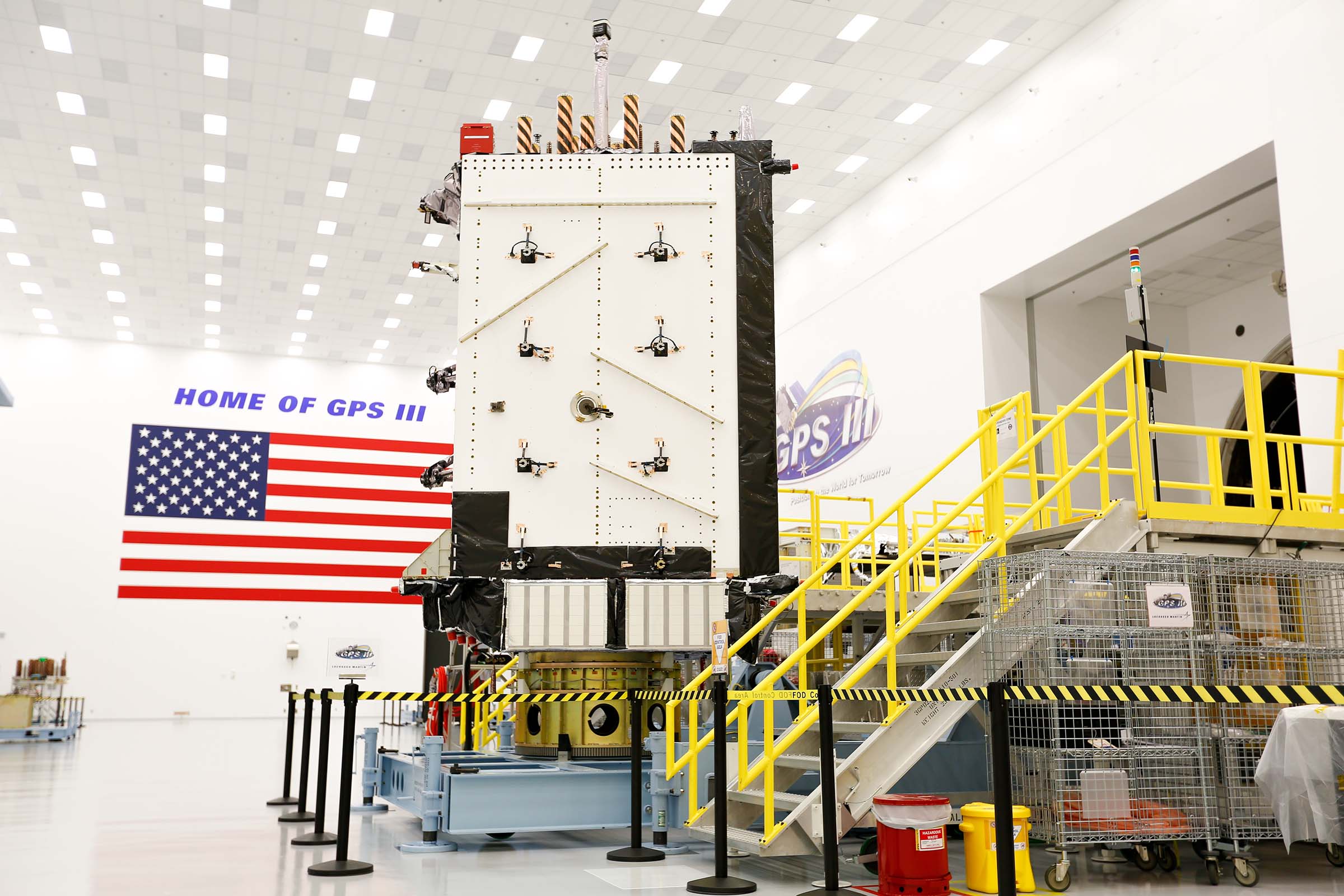
The most consequential infrastructure of the modern world is invisible, free, and owned by a military. The Global Positioning System — a constellation of satellites in medium Earth orbit, each circling the planet roughly twice a day and broadcasting its position and the exact time — was built by the U.S. Department of Defense to answer one question for its own forces: where am I, precisely, anywhere on Earth?
The project began in 1973 as NAVSTAR. The first satellite launched in February 1978; the full constellation of 24 satellites was in orbit by 1993, and the system was declared fully operational in 1995. A receiver that can hear four or more satellites can fix its position — and, just as importantly, can discipline its clock to atomic time. That second function, timing, is the one the world quietly rebuilt itself around.

The tragedy that opened the system
Civilian access was an accident of geopolitics. In September 1983, a Soviet interceptor shot down Korean Air Lines Flight 007 after it strayed into restricted Soviet airspace, killing all 269 people aboard. President Ronald Reagan responded by announcing that GPS would be made available for civilian use once completed — a navigation utility offered to the world so that such an error need never happen again.
But the civilian signal was deliberately degraded. A feature called Selective Availability scrambled the timing data so civilian receivers were accurate only to roughly 100 meters, while military receivers corrected the error and saw clearly. For seventeen years, the public used a blurred version of the system — good enough for hiking, useless for landing planes or running a logistics network.

May 1, 2000: the switch
On May 1, 2000, President Bill Clinton ordered Selective Availability switched off. Overnight, civilian accuracy improved roughly fivefold — and the modern location economy began. The timing was not lost on the military, which by then could deny GPS regionally rather than degrade it globally; the blur was no longer necessary. In 2007, the United States announced the feature would not even be built into the next generation of satellites.

What followed is the largest quiet dependency in technology. The Department of Homeland Security counts GPS as essential to 14 of its 16 critical infrastructure sectors. Mobile networks synchronize on GPS time. Power grids phase-match on it. Financial exchanges timestamp trades with it. Every container ship, tractor, delivery van, and phone call rides on signals from a constellation still operated by the U.S. military — today the Space Force, whose 2nd Space Operations Squadron at Schriever Space Force Base in Colorado runs the system, now flying Lockheed Martin's GPS III satellites.
The lesson of GPS is about what openness does to a platform. As a closed military tool, it was a weapon's guidance aid. The moment its full precision was given away — free, to anyone with a receiver — it became the substrate for industries its builders never imagined. The disruption was not the satellite. It was the decision to stop blurring the signal.
Keep reading
More from the filing cabinet.
Business · News · Asia · South Korea
Humanoids Are Becoming the Memory Industry’s Next Growth Engine
Counterpoint Research expects DRAM demand from humanoid robots to rise more than twentyfold by 2030 — and Samsung and SK Hynix want the AI data-center playbook to repeat.
Technology · News · Europe · Dresden, Germany
Dresden’s Billion-Euro Bet on Chips for the Physical World
GlobalFoundries has topped out its €1.1 billion SPRINT fab expansion and unveiled FDX Fusion — a chip platform designed for what the industry now calls Physical AI.
Business · News · Middle East · Gulf states
Microsoft’s $10 Billion Gulf Framework: the AI Build-Out Goes Sovereign
Redmond’s decade-long commitment to the UAE, Saudi Arabia, Qatar, and Kuwait is about more than capacity — it is about who controls the region’s AI infrastructure.